

Introducing Indonesian first Location as a Service (LaaS) that allows business to get insights from their valuable assets. Our technology is a game-changer in the world of tracking and monitoring assets, people, and equipment. It provides real-time data on the location of assets within a designated area, allowing businesses to optimize their operations and improve efficiency. We will explore the key features of high-accuracy RTLS technology, including real-time data, easy integration, and advanced analytics.
High Accuracy
One of the most important features of WideMetric technology is high accuracy. RTLS systems use various technologies, such as Ultra-Wideband (UWB), Radio Frequency Identification (RFID), Global Positioning System (GPS), and Bluetooth Low Energy (BLE), to track and monitor assets. These technologies provide high-precision location data, enabling businesses to accurately locate assets within a few centimeters.
Real Time Location System (RTLS)
Another key feature of our RTLS technology is real-time data. WideMetric systems provide up-to-the-second data on the location of assets, allowing businesses to make informed decisions quickly. Real-time data is critical in industries where timing is of the essence, such as manufacturing, healthcare, and logistics. Our technology ensures that businesses have the information they need to keep operations running smoothly and efficiently.
Easy Integration
WideMetric technology is designed to be easy to integrate with existing business systems. We provide APIs that allow businesses to integrate location data into their existing software and platforms seamlessly. This makes it easier for businesses to leverage the benefits of WideMetric RTLS technology without having to make significant changes to their existing systems.
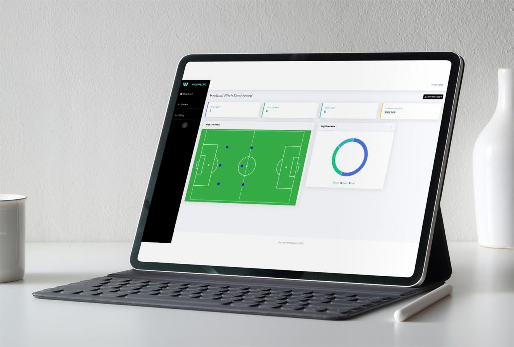
Advanced Analytics
Here is the list of accessible analytics which could be derived from our platform:
- Distance traveled: Calculate the total distance covered by an object or individual over a given period of time.
- Average speed: Compute the average speed of movement by dividing the total distance traveled by the time elapsed.
- Path analysis: Visualize and analyze the path taken by an object or individual, identifying patterns, frequently visited locations, or deviations from a predefined route.
- Heatmaps: Generate heatmaps to identify areas with high activity or density of movements, which can help uncover hotspots, congested areas, or popular locations.
- Cluster analysis: Group similar coordinate points to identify clusters, which can help reveal patterns or areas of interest in the data.
- Dwell time: Analyze the time spent at specific locations or within defined areas, which can help identify areas of interest, rest points, or potential bottlenecks.
- Speed analysis: Determine instances of high or low speeds, which can help identify aggressive driving, compliance with speed limits, or other speed-related patterns.
- Direction analysis: Evaluate changes in direction, turns, or movement patterns to better understand navigation behavior.
- Proximity analysis: Measure how often and how closely an object or individual comes to specific locations, landmarks, or other points of interest.
- Entry/exit analysis: Identify the frequency and timing of entering or exiting specific areas, which can be useful for understanding patterns of movement in and out of defined zones.
- Anomaly detection: Detect unusual movements, deviations from typical patterns, or other anomalies that may warrant further investigation or attention